Portfolio
Take a look!
Also be sure to check out some options for your media below:
Media Delivery Page Sample
How you preview, download, and pay for your deliverables.
Media Download Page Marketing Package Sample
Included with the Microsite: pre-made videos, social post designs, and more.
Sample Marketing Package Scout & Aerial, L.L.C. • Whitsett, NC
Budget Measurement $100.00
Budget Measurement and Floorplan
2D wireframe, minimal labels; no doors/windows
Budget Measurement and Floorplan
2D wireframe, minimal labels; no doors/windows
Budget Measurement and Floorplan
2D wireframe, minimal labels; no doors/windows
Budget Measurement and Floorplan
2D wireframe, minimal labels; no doors/windows
Budget Measurement and Floorplan
2D wireframe, minimal labels; no doors/windows
Basic Measurement $150.00
Basic Measurement and Floorplan
2D/3D includes doors/windows; greyscale
Basic Measurement and Floorplan
2D/3D includes doors/windows; greyscale
Basic Measurement and Floorplan
2D/3D includes doors/windows; greyscale
Basic Measurement and Floorplan
2D/3D includes doors/windows; greyscale
Basic Measurement and Floorplan
2D/3D includes doors/windows; greyscale
Premium Measurement $200.00
Premium Measurement and Floorplan
2D/3D includes doors/windows; full color
Premium Measurement and Floorplan
2D/3D includes doors/windows; full color
Premium Measurement and Floorplan
2D/3D includes doors/windows; full color
Premium Measurement and Floorplan
2D/3D includes doors/windows; full color
Premium Measurement and Floorplan
2D/3D includes doors/windows; full color
Premium Measurement and Floorplan
2D/3D includes doors/windows; full color
Premium Measurement and Floorplan
2D/3D includes doors/windows; full color
Premium Measurement and Floorplan
2D/3D includes doors/windows; full color

Drone Photography Starting at $50
Exterior Drone Photos:
$50 for 4x photos
$100 for 10x photos.
(Interior examples coming soon!)

Property Line Visuals $50
Land listing? Large Acreage? Non-Typical Property Lines?
Consider Property Line Visuals!

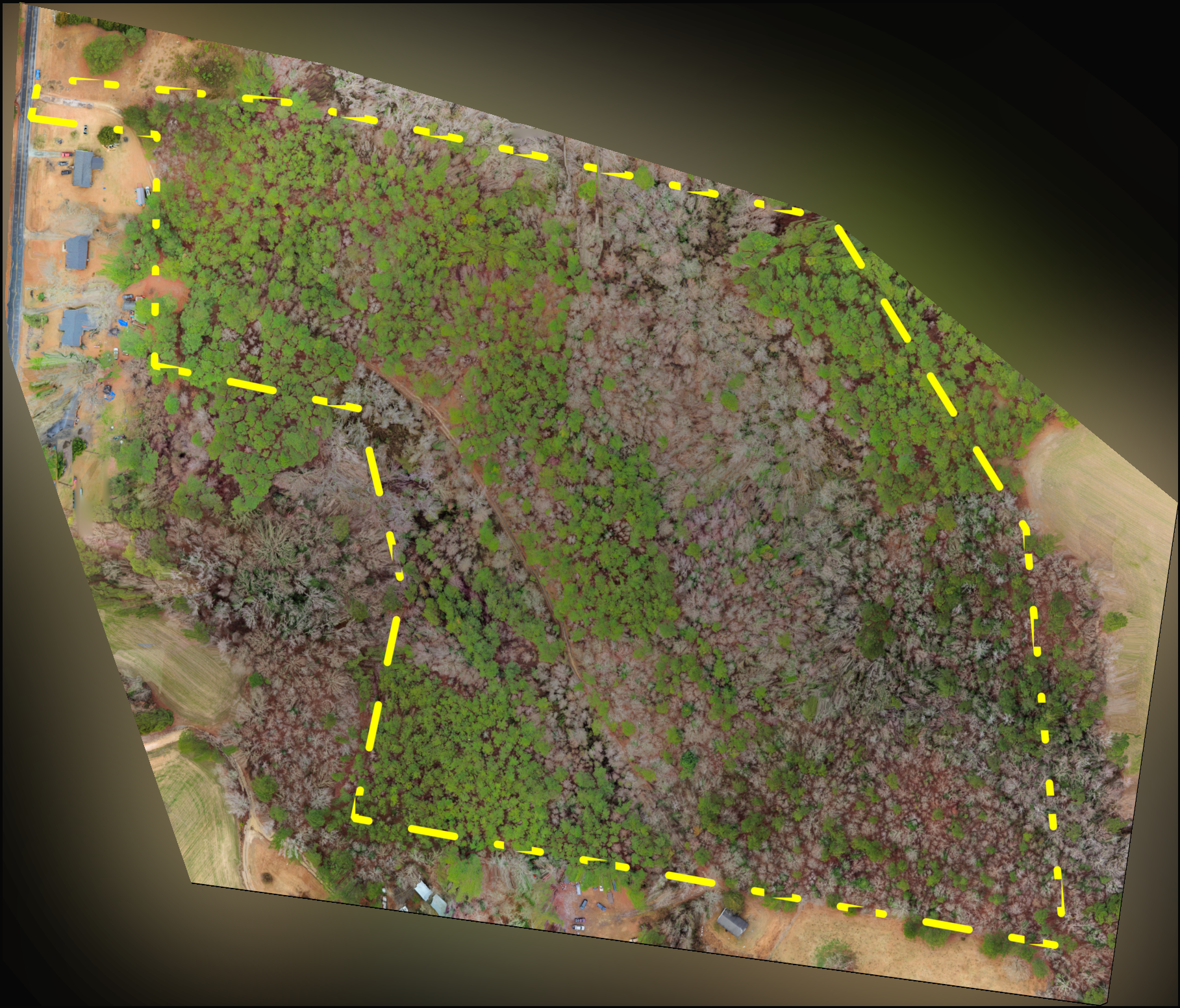
Orthographic Photogrammetry
Got a REAL big acreage?
Consider Orthographic - a series of birds eye HD photos stitched together for a map of the area.
